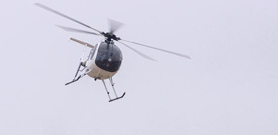
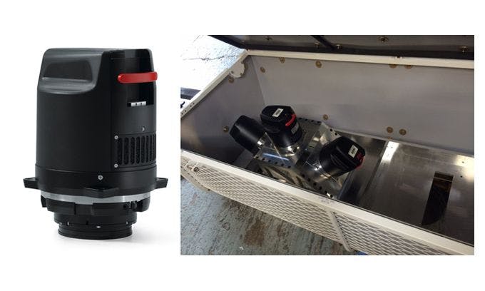
Our team owns and operates a fixed-wing Cessna TU-206G turbo charged for aerial survey projects above 1000’ AGL and leases a Hughes 500 helicopter for low altitude mapping projects. Our Teledyne Optech Galaxy T1000 LiDAR Sensor and Phase One iXM-RS150F Digital Camera are utilized for the acquisition of aerial LiDAR data and imagery for design projects.
Photogrammetric Mapping addresses critical safety issues and reduces the need to close busy travel lanes or place ground survey personnel in the middle of congested, high traffic corridors. In addition to accuracy and safety, Photogrammetric Mapping results in time and cost savings.
Photogrammetric Mapping, Land Surveying
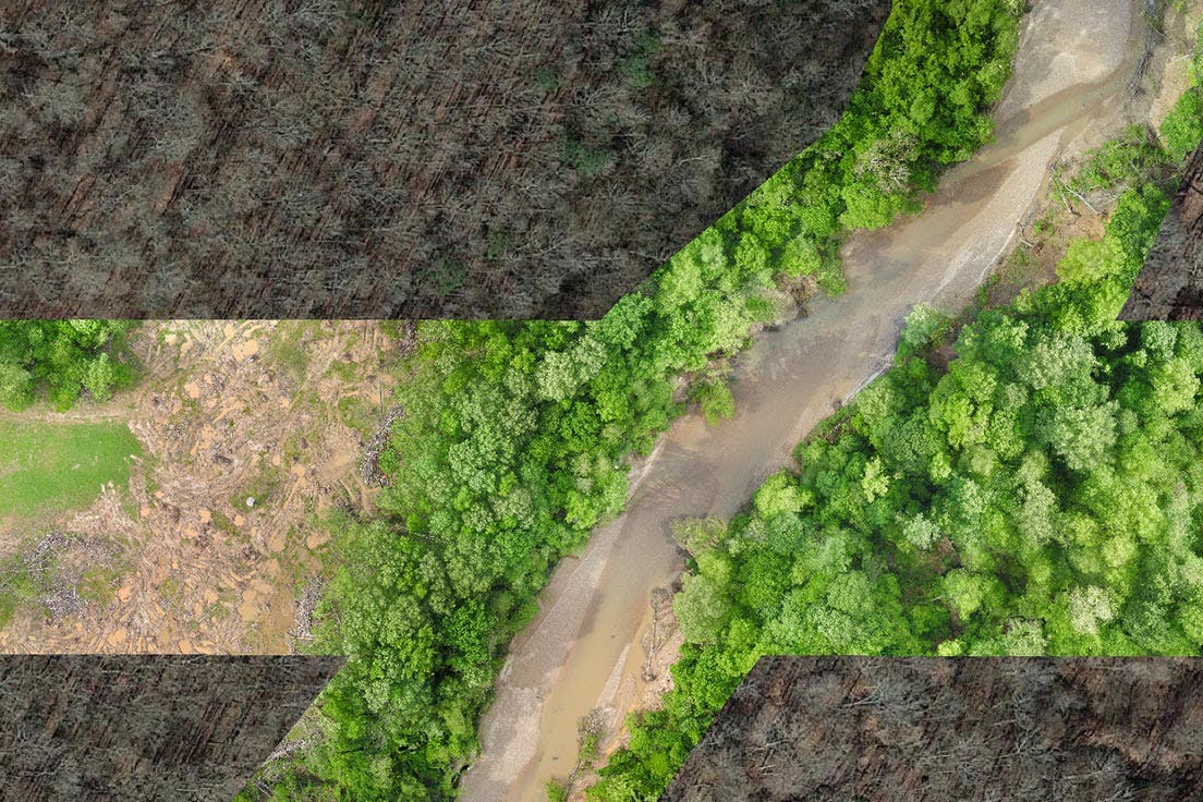
Low Altitude Mapping Photography (LAMP), was acquired at ±350’AGL from MP153.23 to MP169.32, utilizing a Hughes 500 Helicopter and Leica RCD 30 Digital. The imagery acquired from the low altitude flight was utilized to collect all visible planimetric (2D) and terrain (3D) features along the project corridor, mapping included all travel lanes/shoulders and medians for the entire project. A full 3D DTM was collected for the project corridor to 15’ beyond outside shoulder pavement. A Fixed-wing flight at ± 2000’ AGL was performed covering limits defined above to produce a digital mosaic at 1” = 40’ for the corridor in TIFF and HMR formats.

Photogrammetric Mapping, Land Surveying
Low Altitude Aerial Photography for this project was flown with our Hughes 500 Helicopter and Leica RCD 30 Digital Sensor at an altitude of 350’ resulting in accuracies of ± 0.03 to 0.05’ on hard surfaces. The imagery acquired from the low altitude flight was utilized to collect all visible planimetric (2D) and terrain (3D) features on the hard surface areas along the project corridor. Planimetric features were collected outside the hard surfaces to the right-of-way. The aerial target locations and areas of obscured ground were merged with provided control surveys and collected 3D terrain features to produce the final delivery of a SURVRD file in MicroStation SS4.
Aerial LiDar, Photogrammetric Mapping, Land Surveying
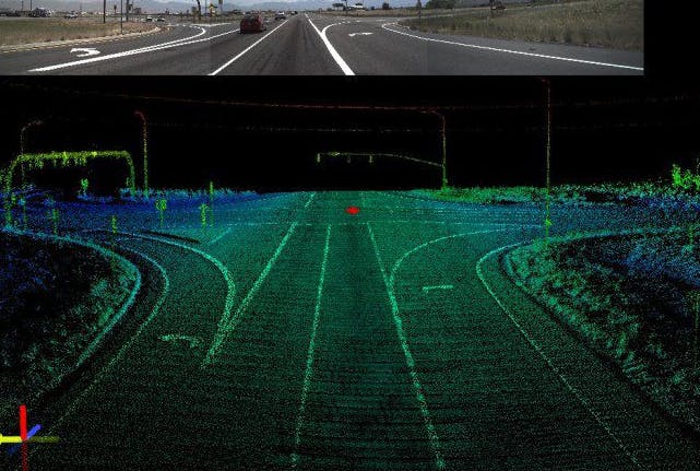
Aerial LiDAR was acquired for the project limits to create a surface model for design. Digital imagery was collected during the LiDAR acquisition and utilized to collect Planimetric detail.A full 3D DTM was performed for the project limits to EOR defined limits. Utilizing our fixed-wing aircraft, the Aerial LiDAR mission was planned to utilize an Optech Galaxy Aerial LiDAR Sensor at ± 1000’ AGL with a 32-degree field of view at 30% side lap to achieve better point density for the entire project corridor. The Aerial LiDAR data was acquired at a point density of ± 84 points per square meter (ppsm) per single swath resulting in an average ± 124 ppsm. MicroStation and TerraScan were utilized to Classify the Point Cloud to create a Bare Earth model for data extraction. Using the aerial Bare Earth Aerial LiDAR data, aerial photography, the aerial triangulation solution and the ground control, IFR photogrammetrists accurately compiled DTM surface and planimetric data utilizing digital photogrammetric workstations.